Keweenaw Bike maps
How to use this map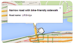
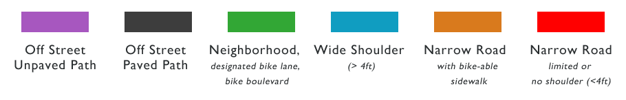
Road segments have been colored to designate suggested use (see key below). As you explore the map click on a road segment for the road name and designated use.
|
Want More?
See our points of interest location map: find bike racks, bathrooms, tricky intersections, and local businesses that might interest cyclists! Or download a PDF version for printing:
|
These maps were developed by volunteers, based on road conditions observed in the summer of 2013. Be aware that conditions may change based on weather, road construction and other factors.
Highlighted roads and paths have been categorized based on characteristics such as traffic and shoulder width, but there are no officially recognized or recommended routes.
Bike Initiative Keweenaw (BIKE!) and other entities that link to these maps do not guarantee the safety or appropriateness of routes chosen by cyclists using these maps, and remind all riders to obey applicable traffic laws, bike defensively, and always wear a helmet.